Cycling in the hills of Bologna: the Via Casaglia scenic loop
Updated on 27 March 2026 From Federico Farinelli

Updated on 27 March 2026 From Federico Farinelli
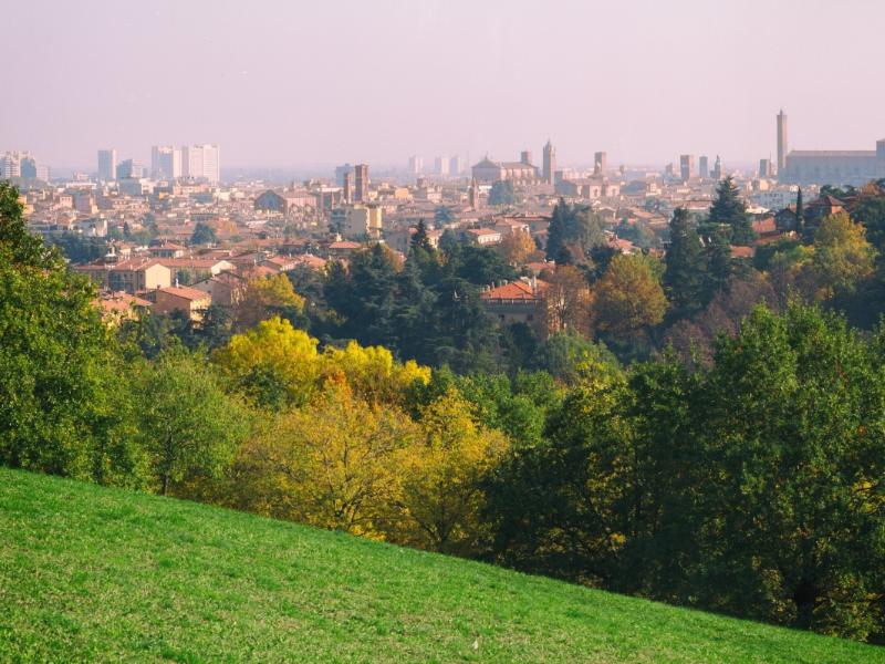
Cycling among the rolling silhouettes of the Bologna hills is a must-try experience for those who love cycle tourism and the outdoors. Thanks to the city's location at the foot of the Apennines, it is easy to escape the urban traffic and immerse yourself in the greenery and tranquility of the first slopes just outside the historic center.
One of the most pleasant and interesting rides is the one climbing up from Via di Casaglia, in the Saragozza area; thanks to steady but manageable gradients, this itinerary is suitable for everyone who enjoys cycling as a sport, or even for those who, with a modern e-bike, want to explore the city's most beautiful views without too much effort.

• Type: Loop ride on the Bologna hills
• Duration: 1h / 1h30 – Length: approx. 20km
• Recommended bike: Road bike, Gravel or MTB
• Level: Suitable for intermediate cyclists (430m elevation gain)
• E-bike: Suitable for everyone
• Features: Low-traffic roads, panoramic views and hilly parks.
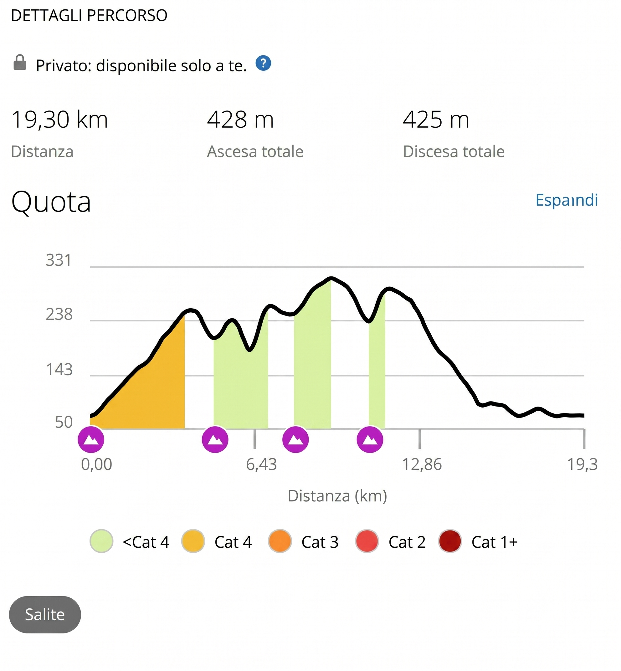
Elevation profile from Garmin Connect
Following via Saragozza from the center towards
Casalecchio, we turn left at the junction with via di Casaglia: this is where
our ride begins. The ascent starts immediately, with some challenging ramps
flanking the picturesque Villa Spada Park. After the first
steep section, you'll encounter a couple of hairpin bends which, once cleared,
give way to a gently sloping stretch that leads into the hilly area.
Here we find San Pellegrino Parkand the Trecento Scalini (Three Hundred Steps) on the right, iconic spots for picnics and summer aperitifs on the
Bologna hills, while on the left, several clubs, small restaurants, and
farmhouses will certainly pique our post-ride fantasies. But
let's refocus on the road towards Monte Albano. The climb to
this cluster of buildings continues in a pleasant and linear fashion. (Here you can opt
for option 1*).
We are at the end of the actual climb and ahead of us,
on the left, a green clearing opens up where we spot the historic church of
Santa Maria Assunta di Casaglia. This marks the beginning of a more varied section, made
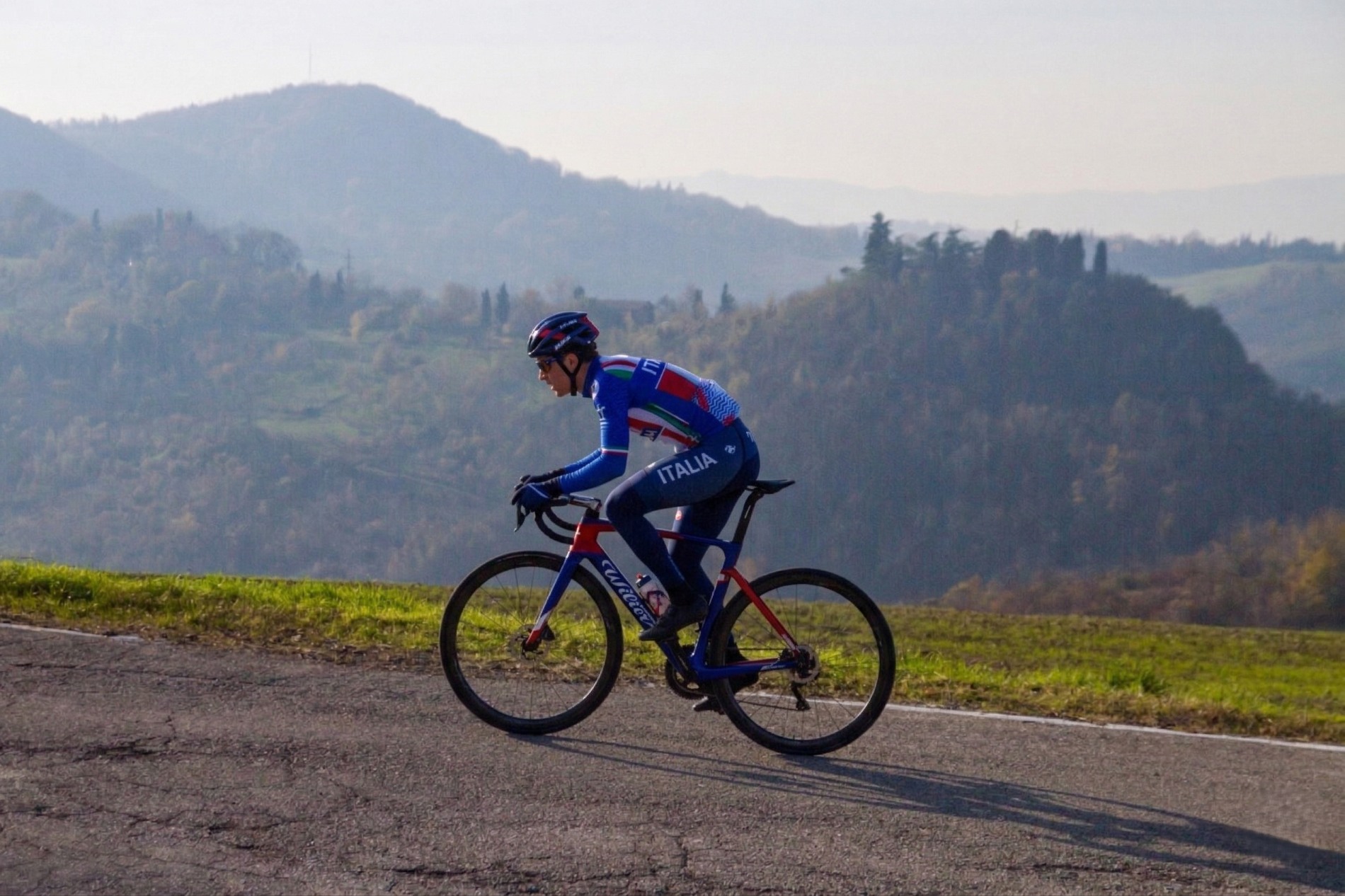
of rolling hills with breathtaking panoramic points, until reaching
the demanding gradients of Cavaioni Park (the Strava segment is
aptly renamed "Muro di Cavaioni," with gradients between 15%-20% in the
final stretch). After this grueling ramp, you can choose to take a break
to enjoy the panoramic view over the Reno Valley (from the
parking lot on the right) or a break at the park's kiosk. (At this
point you can opt for options 2 and 3**).
The itinerary continues and further on we turn right at the intersection onto the scenic Via delle Lastre; here too, the road climbs and dips towards Monte Donato, in the heart of ForteBandiera Park. There is no shortage of evocative views and steep ramps, but these are the last ones. From here, in fact, begins a fun descent which, first via via Siepelunga and then via via Santa Barbara, leads back to the city by the GiardiniMargherita. Coasting along this city park, you finally arrive at Via Castiglione, which reconnects to the "Viali," the ring road system of Bologna's historic center.
Via the cycle path, we head back towards the starting point, turning left to close our loop on the pedals.
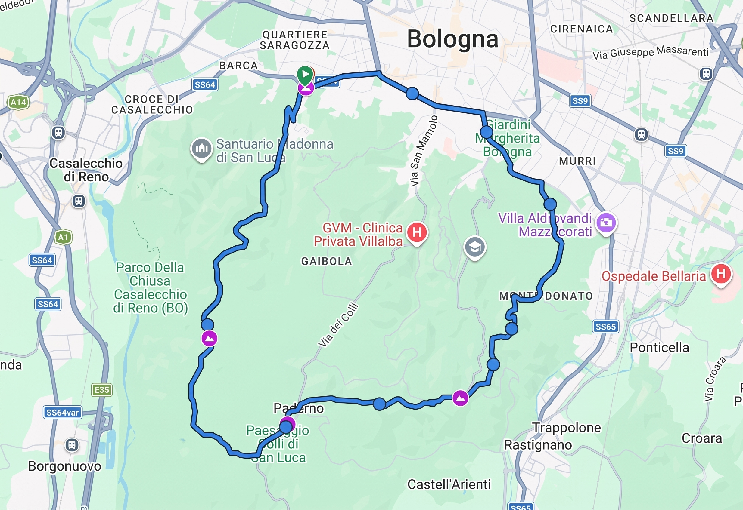
Map from Garmin Connect


Discover Bologna Welcome's newsletters and choose the one that suits you best: events, tips, tours delivered directly to your inbox
Subscribe


